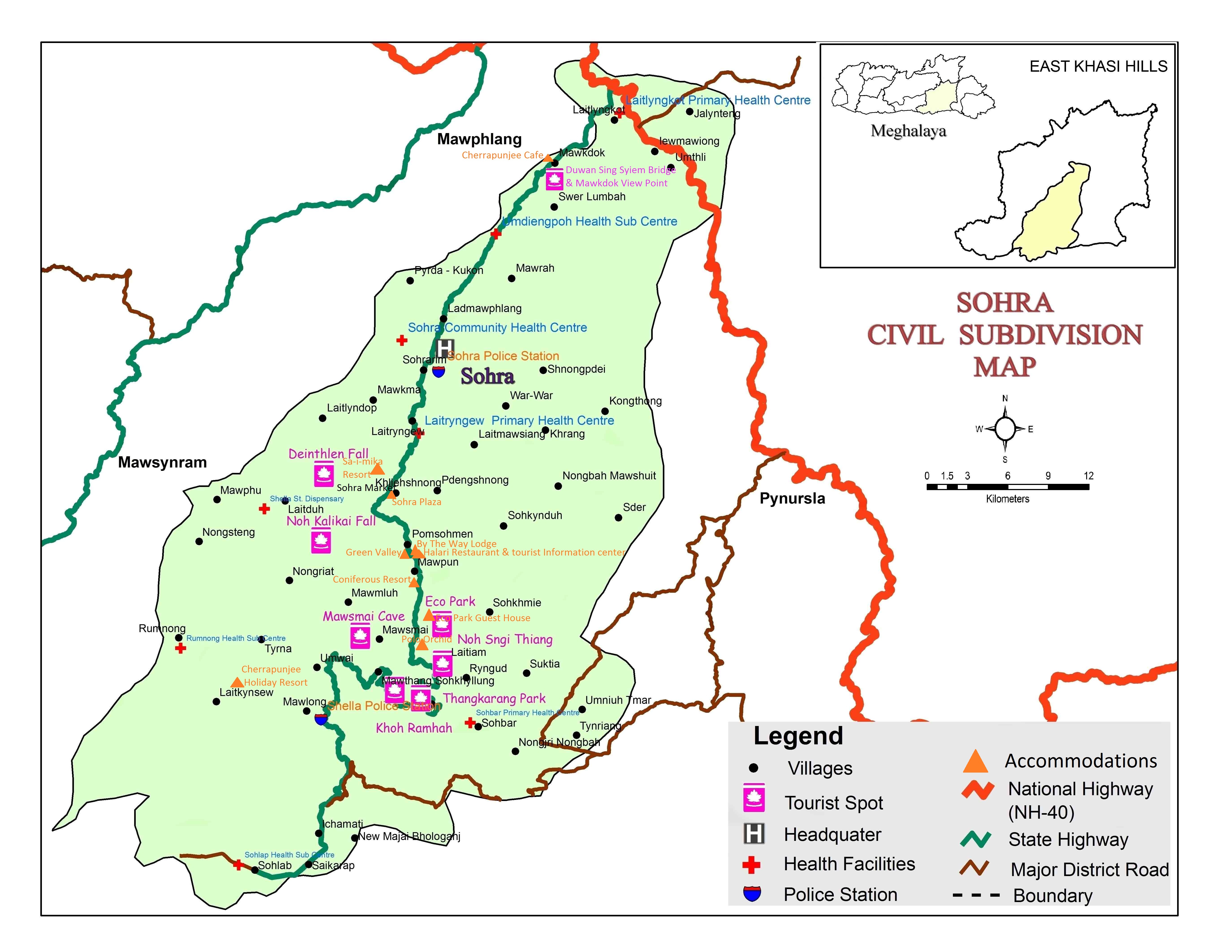
Located at 25.30 N and 91.70 E, Sohra, previously known as Cherrapunjee, was established as a Sub-Division in the East Khasi Hills District of Meghalaya in 1982. Set upon a plateau that rises 600 metres above the surrounding valleys on the southern slopes of the state. The terrain in and around Cherrapunjee is an undulating one with pockets of shrubs. The steep slopes in the gorges are covered by tropical rain forests. In many places there is hardly an inch of topsoil but mostly rock outcrop. The condition of topsoil is rocky in nature and is not conducive for vegetation growth. However, geologists felt that once upon a time, the table land of Cherrapunjee must have been thickly forested.
The four main seasons of Meghalaya are Spring (i.e. March to April), Monsoon (May to September), Autumn (October to November) and Winter (December to February).The temperature starts warming by the third week of May and continues right to the end of September and sometimes gets extended well into the middle of October. The average rainfall is 12,000 mm a year, with the maximum rainfall occurring over the southern slopes of the Khasi Hills in Sohra. The highest recorded total annual rainfall was 24,555 mm in 1974. However, the rainfall over the years has dwindled considerably (13364.2 mm in 2012).
Excessive rain in the region has rendered the condition of the soil poor by washing away the topsoil. Soil condition is also hampered due to deforestation which in return causes drought in winter. The vegetation is xerophytic. Valleys around the place are covered with diverse vegetation. There are several endemic species of plants in the valleys.
Cherrapunji receives rains from the Bay of Bengal arm of the Indian summer monsoon. The monsoon clouds fly unhindered over the plains of Bangladesh for about 400 km. Thereafter, they hit the Khasi Hills which rise abruptly from the plains to a height of about 1370m above mean sea level within 2 to 5 km. The geography of the hills with many deep valleys channels the low-flying (150–300 m) moisture-laden clouds from a wide area to converge over Cherrapunji. The winds push the rain clouds through these gorges and up the steep slopes. The rapid ascent of the clouds into the upper atmosphere hastens the cooling and helps vapours to condense. Most of Cherrapunji's rain is the result of air being lifted as a large body of water vapour. The extreme amount of rainfall at Cherrapunji is perhaps the best-known feature of orographic rain in northeast India. Occasionally, cloudbursts can occur in one part of Cherrapunji while other areas may be totally or relatively dry, reflecting the high spatial variability of the rainfall. Atmospheric humidity is extremely high during the peak monsoon period.
A notable feature of monsoon rain at Cherrapunji is that most of it falls in the morning. This could be partly due to two air masses coming together. During the monsoon months, the prevailing winds along the Brahmaputra valley generally blow from the east or the northeast, but the winds over Meghalaya are from the south. These two winds systems usually come together in the vicinity of the Khasi Hills. Apparently the winds that are trapped in the valley at night begin their upward ascent only after they are warmed during the day. This partially explains the frequency of morning rainfall. Apart from orographic features, atmospheric convection plays an important role during the monsoon and the period just preceding it.

Cherrapunji was initially named as Sohra, pronounced as "Churra" by the British. But however now again the government of Meghalaya is decided to refer Cherrapunji by its original name. There are evidences for this place being under the British for a period like one can see the monument of David Scott who was the British Administrator in NE India, 1802–31.Though the place receive rainfall throughout the year irrigation is not possible here because of heavy rain the topsoil is washed away and as a result of this you can see encroachment of the people into the forest.
The word "Cherrapunji" means 'land of oranges'. Despite perennial rainfall, Cherrapunji faces an acute water shortage and the inhabitants often have to trek for miles to obtain potable water. The Meghalaya state government has renamed Cherrapunjee back to its original name, "Sohra". The history of the Khasis – the inhabitants of Cherrapunji – may be traced from the early part of the 16th century. Between the 16th and 18th centuries these people were ruled by the 'Syiems (rajas or chiefs) of Khyriem' in the Khasi hills. The Khasi hills came under British authority in 1883 with the submission of the last of the important syiems, Tirot Singh.
Cherrapunjee’s original name is ‘Sohrapoonjee’. ‘Poonjee’ refers to the head village where the seat of power of the Chieftain is. The English who ruled over this place from 1830-1947 could not pronounce ‘Sohrapoonjee’ correctly and as was typical of them named it ‘Cherrapunjee’. People who do not know the origin of the name also spell Cherrapunjee as ‘Cherrapunji’. Popular usage is Cherrapunjee, while we the people of the place continue to call it ‘Sohra’ only. Some old colonial period writings refer it as ‘Chirra’ too.
Some of the minerals found in and around Cherrapunjee are as follows :
The people who inhabit Cherrapunjee and surrounding villages are known as Khasis. The people living further down Cherrapunjee in the southern slopes and in the valleys are known as War-Khasis. A notable feature of the Khasis is the system of matrilineal lineage, where the lineage is taken from the mother’s side. The man goes to live in his wife’s house after marriage. The children take the surname of the mother. The responsibility of looking after the parents in their old age devolves on the youngest daughter. Amidst the Khasis the ancestral property goes to the youngest daughter whereas amidst the War-Khasis it is divided equally among the children.
The Khasis are divided into a number of clans, which trace their descent from ancestress or kiaws. The descendants of one common ancestress are called Kur. A sub-clan is called Shi Kpoh. The smaller division of the clan is the family (iing). Members of clans and sub-clans having a common ancestry cannot marry within the Kur and Kpoh.
The Khasi woman enjoys a much greater share of liberty than any other women in the country. The Khasis are fairly free to choose their marriage-partners, a choice, which is motivated by personal preference rather than family considerations. There is no bride price or dowry. Socially women are considered as equal to men. Yet, in the traditional political system, her role was insignificant. Education has wrought great changes over the years. Women are found to be in diverse professions and somewhat independent. They dominate markets, and have taken to teaching and nursing. Many hold high posts in government offices, university, and colleges and also other kinds of jobs.
The traditional system of administration is through the Dorbars – Dorbar Shnong for village level, Dorbar Hima for the Syiemship / Chieftainship level, with elected headman/ Sirdar at the village level and Syiem at the level of Kingdom / Chiefdom / Syiemship. The Khasi society is generally egalitarian but certain families alone may offer its males to the office of Chief (Syiem) in the Khasi States (Hima). There is a hierarchical ranking in the himas with mayors (Basan), nobles (Bakhraws), priests (Lyngdohs), prime ministers (Lyngskors), electing and regulating the activities of the hima, Syiems, Lyngdohs and Sirdars. Certain clans have religious functions like Lyngdohs. In the Dorbar Shnong at village level and the Dorbar Hima at the Kingdom level only men are allowed to participate and vote. The Khasi himas exist even now as they serve important social and religious functions.
The Khasi people are mainly engaged in agricultural activity. The vegetation unlike the wet areas is not lush green but appear in patches. Cherrapunji produces the best quality of oranges and pineapple. There are also few products, craft work and industry in Cheerapunji.
- Arts and crafts: Cherrapunjee is famous for its Bamboo Handicrafts, especially products made of bamboo and cane.
- Local Products Honey:The lovely town is also famous for its honey known as “Genuine Orange Flower Honey”
- Industry: Mawmluh Cherrapunjee Cement Limited (MCCL)
It is the only profit making public sector undertaking in Meghalaya. It has achieved the highest production and dispatch of cement in 5 years. During 2000-01, it exceeded 1.20 lakh tones which is a record since 1996-97.
The people of Cherrapunjee have, therefore, to find their livelihood by pursuing other occupations. Cherrapunjee i.e. Sohra has evolved as a market place for the produce of the villages around Cherrapunjee and the needs of provision for the people of the area. The fruits from the villages around are sold in Sohra market as the fruits of Sohra, whereas almost nothing grows in Sohra. In Khasi language, ‘Soh’ means fruit and ‘rah’ means carry. Since the fruits of Sohra are carried from the villages around, it is alluded that ‘Sohra’ got its name from ‘Soh’ and ‘rah’. We cannot vouch for the correctness of this assumption.
Visitor No.:
Updated on 27-01-2017